Cruising the Intracoastal Waterway: A First-Timer's Guide
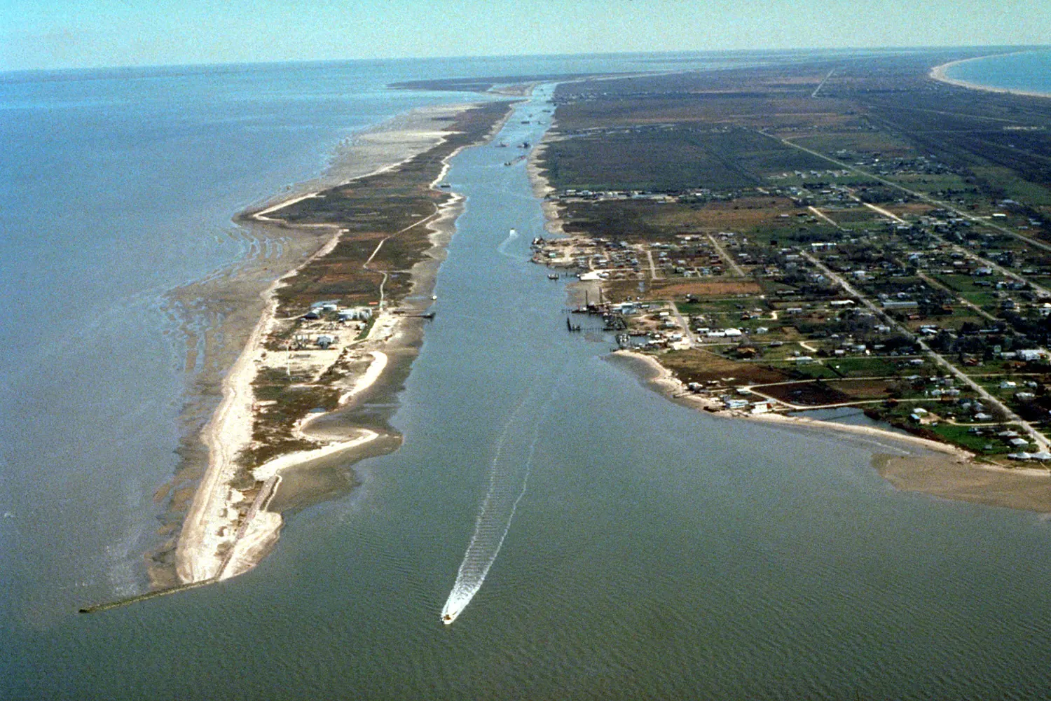
The Atlantic ICW runs about 1,090 statute miles from Norfolk, Virginia (Mile 0) down to Key West, Florida, and the Gulf ICW adds roughly 1,300 more miles from Carrabelle, Florida to Brownsville, Texas. Most first-timers running the Atlantic route point-to-point take 4 to 8 weeks, averaging 50 to 60 miles a day. If you're planning your first trip, the honest advice is to plan for less mileage per day than you think you need, because the ICW moves at its own pace.
I'm not a delivery captain, I'm a hull diver. But I've worked on plenty of boats that just came off a long ICW run, and the bottom always tells the story: what grew on it, how fast, and where the owner got lazy about timing a bridge or a tide. That's the perspective I'm writing from here.
Key takeaways
- The Atlantic ICW is about 1,090 miles, Norfolk to Key West, marked by mile markers (Mile 0 at Norfolk).
- Plan on 50 to 60 nautical miles a day at 6 to 8 knots if you're running a trawler or sailboat under power.
- Controlling depth is nominally 12 feet in the Atlantic ICW's southern reaches, but shoaling to 5 to 6 feet is common, especially in Georgia and parts of the Carolinas.
- Most fixed bridges clear 65 feet, but there are exceptions as low as 49 to 56 feet, so know your exact mast height before you leave the dock.
- Fall (October to November) southbound and spring (April to May) northbound are the two traditional cruising windows.
What exactly is the ICW, and where does it run?
The ICW isn't one continuous ditch, it's a mix of natural rivers, sounds, bays, and dredged cuts strung together and marked with red and green aids plus mile-marker signs. The Atlantic ICW starts at Mile 0 in Norfolk, Virginia, runs through the Dismal Swamp Canal or the Virginia Cut (two route choices right out of the gate), down through Albemarle and Pamlico Sounds in North Carolina, past Beaufort and Charleston, through Georgia's marsh country, and into Florida at Fernandina Beach, ending around Key West.
The Gulf ICW is a separate system starting near Carrabelle, Florida, running through Mobile Bay, past New Orleans, and along the Texas coast to Brownsville. A lot of East Coast cruisers do the Atlantic ICW southbound in fall, then either keep going on the Gulf side or head offshore to the Bahamas or Florida Keys.
There's no toll to run the ICW itself. You'll pay for marinas, fuel, and the occasional lock (Great Bridge Lock and the Dismal Swamp locks are free but run on a schedule).
How long does it take, and how fast should I plan to go?
Most cruising boats, whether it's a 34-foot trawler or a 40-foot sailboat under power, run 6 to 8 knots on the ICW. At that speed you'll cover 50 to 60 nautical miles in a 7 to 9 hour travel day, which is about as long as most people want to be at the helm watching for crab pots and shoaling.
A straight-through run of the Atlantic ICW can be done in 3 weeks if you push hard and skip stops. Realistically, first-timers take 4 to 8 weeks because they stop to explore Beaufort, Charleston, St. Augustine, and other towns along the way, and because weather, fog, or a bridge outage will cost you a day here and there no matter how well you plan.
Don't schedule a hard arrival date if you can avoid it. The ICW has a way of making you wait a tide cycle or a day for wind to lay down, and cruisers who build in slack are the ones who actually enjoy the trip.
What about depths and bridges?
The Army Corps of Engineers targets a controlling depth of 12 feet through most of the Atlantic ICW's southern half, but that's a target, not a guarantee. Shoaling is a known, ongoing problem in specific spots: Georgia's marshy stretches, parts of the North Carolina/South Carolina line near the "Rock Pile" north of Myrtle Beach, and inlets that migrate after storms. Boats drawing more than 5 feet need to check current conditions before transiting those areas. Waterway Guide and Active Captain (now folded into Garmin) both carry crowd-sourced depth reports that are more current than any chart.
Bridges are the other big variable. Most fixed highway and rail bridges clear 65 feet, but there are known low spots, including bridges as low as 49 to 56 feet in parts of Florida. If your mast or antenna array is close to 64 feet, measure it exactly before you go, because "close enough" has ended plenty of trips early.
Bascule and swing bridges either open on a set schedule (often on the hour or half hour, sometimes restricted during rush hour) or open on request over VHF channel 09 or 13. Get a current bridge schedule for your route before you leave, they change more often than people expect.
Anchor out or run marina to marina?
Both are normal on the ICW, and most cruisers mix the two. Free anchorages are common in coves and rivers just off the main channel, and a lot of experienced ICW cruisers anchor out more nights than not to keep costs down. Marina rates along the ICW typically run $1.50 to $3.00 per foot per night, plus power, so a 40-foot boat is looking at $60 to $120 a night at a marina versus free at anchor.
The tradeoff is showers, laundry, fuel, and provisioning access. Most cruisers plan a marina stop every 3 to 5 days to restock and clean up, then anchor the rest of the time.
One thing that catches first-timers off guard: warm, brackish water in Georgia and Florida grows marine growth fast. A hull that's clean leaving Norfolk can pick up a real slime and barnacle strike within 3 to 4 weeks sitting at anchor in that water, especially around the prop and thru-hulls. It won't slow you down much over a few weeks, but if you're stopping for any length of time, or heading offshore after the ICW, it's worth having someone look at the bottom and running gear before you leave. I do that kind of inspection work out of San Diego Bay on the West Coast, but the growth problem is the same no matter which coast you're on, warm water grows things fast and cold water grows things slow.
What do first-timers get wrong most often?
The biggest mistake is treating the ICW like a highway with a schedule. It's shallow, it shoals, and bridges don't care about your itinerary. Build slack into your plan.
The second mistake is not knowing your exact draft and air draft (mast height) cold. "About 4 and a half feet" isn't good enough when you're staring at a 5-foot shoal on a falling tide.
The third is running at low tide through known shallow stretches instead of timing them for mid to high tide. A few hours' difference in tide stage can be the difference between 4 feet of water and 7 feet in some of the tighter Georgia cuts.
Last one: skipping a pre-trip once-over on the boat. Zincs, running gear, stuffing box, seacocks. A long ICW run puts hours on the engine and hardware that a boat sitting at a home dock never sees. Check it before you leave, not after something fails in a narrow channel with a following current.
FAQ
How long does it take to cruise the whole ICW? Most first-timers running the Atlantic ICW point to point take 4 to 8 weeks, averaging 50 to 60 miles a day. A fast, no-stops run can be done in about 3 weeks, but most cruisers slow down to visit towns along the way.
Do I need a shallow draft boat for the ICW? A draft of 5 feet or less makes life easier and keeps more of the route open to you without close tide-timing. Boats drawing 6 feet or more can still run it, but they need to check current depth reports and time shoal crossings around high tide.
What is the best time of year to run the ICW? Most cruisers go southbound in fall, October through November, to beat cold weather and stay ahead of hurricane season's tail end. Northbound trips are typically spring, April through May, timed to avoid summer heat and storm season in the Southeast.
Are there tolls or fees on the ICW? There are no tolls on the waterway itself. You'll pay for marinas ($1.50 to $3.00 per foot per night is typical), fuel, and pump-out, but the two lock systems on the northern Atlantic ICW (Great Bridge and the Dismal Swamp locks) are free, just scheduled.
Do I need a chartplotter, or can I get by with paper charts? A GPS chartplotter with up-to-date ICW charts is standard now, and most cruisers pair it with a current cruising guide (Waterway Guide is the classic) for local knowledge on shoaling and anchorages. Paper charts are still smart to carry as backup in case electronics fail.
Final thoughts before you cast off
The ICW rewards patience more than horsepower. Know your draft and air draft, time the shallow spots to the tide, build slack into your schedule, and check your zincs and running gear before you leave the dock. If you've got questions about prepping a boat's bottom and hardware for a long coastal run, feel free to reach out, I'm happy to talk through what to check before you go.
SCHEMA NOTES
FAQPage Q&As: 1. Q: How long does it take to cruise the whole ICW? A: Most first-timers running the Atlantic ICW point to point take 4 to 8 weeks, averaging 50 to 60 miles a day. A fast, no-stops run can be done in about 3 weeks, but most cruisers slow down to visit towns along the way. 2. Q: Do I need a shallow draft boat for the ICW? A: A draft of 5 feet or less makes life easier and keeps more of the route open to you without close tide-timing. Boats drawing 6 feet or more can still run it, but they need to check current depth reports and time shoal crossings around high tide. 3. Q: What is the best time of year to run the ICW? A: Most cruisers go southbound in fall, October through November, to beat cold weather and stay ahead of hurricane season's tail end. Northbound trips are typically spring, April through May, timed to avoid summer heat and storm season in the Southeast. 4. Q: Are there tolls or fees on the ICW? A: There are no tolls on the waterway itself. You'll pay for marinas ($1.50 to $3.00 per foot per night is typical), fuel, and pump-out, but the two lock systems on the northern Atlantic ICW (Great Bridge and the Dismal Swamp locks) are free, just scheduled. 5. Q: Do I need a chartplotter, or can I get by with paper charts? A: A GPS chartplotter with up-to-date ICW charts is standard now, and most cruisers pair it with a current cruising guide for local knowledge on shoaling and anchorages. Paper charts are still smart to carry as backup in case electronics fail.
BlogPosting summary: A practical, first-timer's guide to cruising the Intracoastal Waterway covering distance, timing, depths, bridges, anchoring versus marinas, and the most common rookie mistakes.
Suggested images: - Alt: "Sailboat running the Intracoastal Waterway through a marked channel with mile marker sign visible" - Alt: "Bascule bridge opening for boat traffic on the Intracoastal Waterway"
Ready for a cleaner, faster hull?
San Diego underwater hull cleaning, zinc replacement, and dive surveys. Owner-operated, permitted, and on a schedule you can count on.
Get your free quote